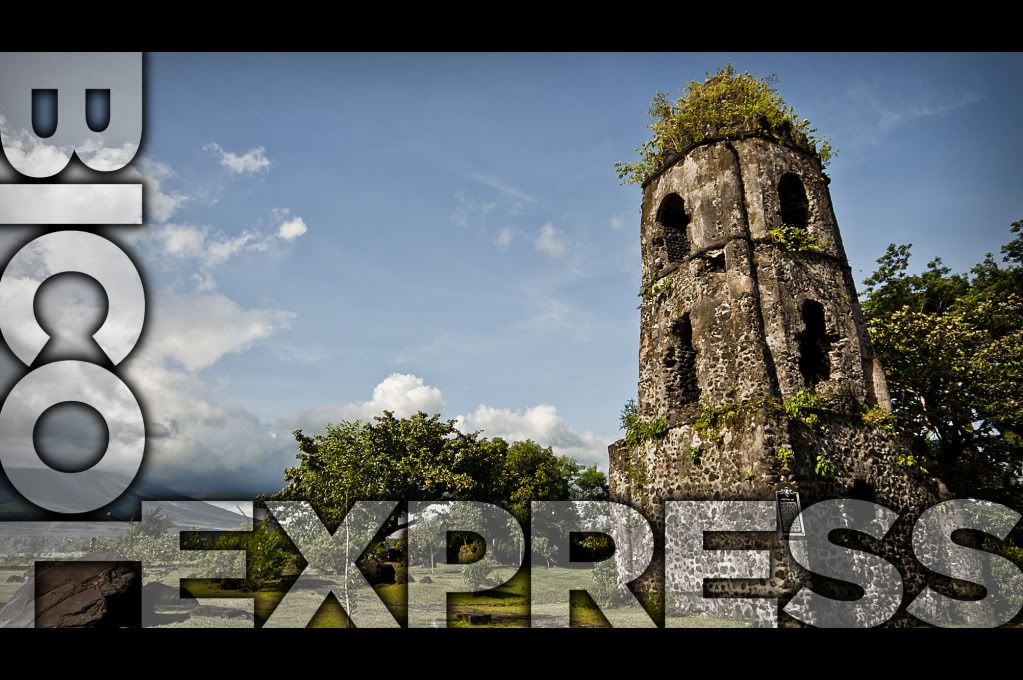
Bicol Express: Ang Byaheng Bicol
ITLog No.10
(16-18 September 2011)
What would you think of, when you say Bicol?
We usually think of the Food Bicol Express or Laing, the Mayon Volcano and the Feast of our Lady of Peñafrancia.
Bicol Region lies at 122° to 124° east longitude and 12° to 14° latitude or generally at the midsection of the country. Occupying the southern stretch of Luzon, the Bicol Peninsula is surrounded by natural barrier like bodies of water. The area is bounded on the north by Lamon Bay and Pacific Ocean on the East, the Sibuyan Sea and Ragay Gulf on the west. It has land access to the rest of Luzon through its neighbor on the north, Quezon Province.
The Bicol Region stretches towards the Pacific Ocean for more than 160 miles from the province of Camarines Norte in the northwest, to Sorsogon in the southwest. The underbelly of Bicol is composed of the provinces of Catanduanes and Masbate, which stand guard on the northern and southern approaches.
The Bicol region is composed of four contiguous provinces: ALBAY, CAMARINES SUR, CAMARINES NORTE, and SORSOGON; two island provinces of CATANDUANES and MASBATE and seven cities namely Legazpi City, Naga City, Iriga City, Tabaco City, Ligao City, Sorsogon City and Masbate City.
It has a total land area of 1,763,249 hectares of approximately 17,632,400 square kilometers. Camarines Sur is the biggest with 526,682 (Naga City and Iriga City included) and Catanduanes, the smallest with 151,148 hectares. The other provinces have the following areas: Albay-Legazpi – 255,257 has.; Camarines Norte – 211,249 has.; Masbate – 404,769 has. Of this land area, 1,250,460 hectares are alienable and disposable land while 359,789 hectares are public forest areas.
Long before any westerners reached the region, the ancient Bicols (the people) already has the culture of their own. They called their land IBALON, possibly after their chieftain-DATU GAT ABAAL, who ruled the inhabited territories from his seat of power at Sawangan on the mouth of Makabalo River, which is now the present day Legazpi City.
The sword and the cross of Spain reached Ibalon in 1570 when part of Legazpi Urdaneta expeditionary force headed by two Augustinian friars, Fr. Alonzo Jimenez and Fr. Juan Orca landed at the southwestern coast of the western peninsula. They named the southern part of the peninsula “TIERRA DE IBALON” and the northern part, “TIERRA DE CAMARINES”. Tierra de ibalon is also referred to as the first Christian settlement in the island of Luzon.
After the Christianization and colonization of Ibalon , the peninsula was divided in to two encomienda, the eastern portion. The Encomienda de Busaingan went to Pedro Arnedo, while the other half was given to Rodrigo Arias Giron. Busaingan, which means “breaker”, was the name given to the coastal settlement of the southern tip of Luzon, The present town of Santa Magdalena in Sorsogon Province.
Ibalon had a port call for galleon plying the Manila-Acapulco route. Historians believed that this could be what is now known as the port of Legazpi City. It was at this port that Bishop Salazar, the first bishop assigned to the Philippines, was stranded for the few weeks during he was able to learn the abuses of encomienderos.
It was believed that the report of Bishop Salazar could have been one of the causes for the abolition of the encomienda system in Ibalon, thus, paving the way for the birth of two original Bicol provinces- AMBOS CAMARINES which included Albay and Sorsogon.
The boundaries of the Region were clearly delineated in a decree issued by Spanish Governor General Narciso de Claveria on October 19,1836, fixing the territorial limits, Ambos Camarines underwent a series of divisions and fusions until 1919 when the Philippine Legislature enacted Act. No. 2809, creating the separate province of Camarines Sur.
Partido de Ibalon, which comprises the eastern part of the peninsula, had a change in name very much earlier when a decree was issued in 1663 renaming this political subdivision Albay. Some of the town of Ambos Camarines and Ibalon were interchanged. The islands of Catanduanes and Masbate were declared separate military districts.
Sorsogon, which used to be part of Albay beacame a province in 1894. By virtue of an executive order issued by Governor-General in 1908, Masbate was made a sub-province of Albay by the American Civil Government. It became an independent province on October 26, 1945 by virtue of the Commonwealth Act No. 687.
But presently, as the Bicolanos go back to rediscover their beginnings, they still favor the more native name: KABIKOLAN or simply BIKOL.
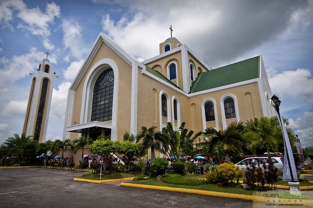
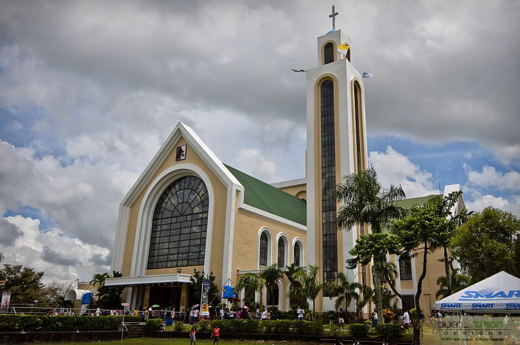
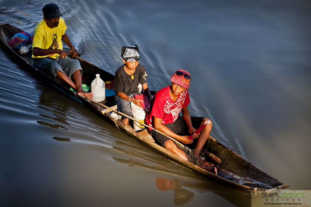
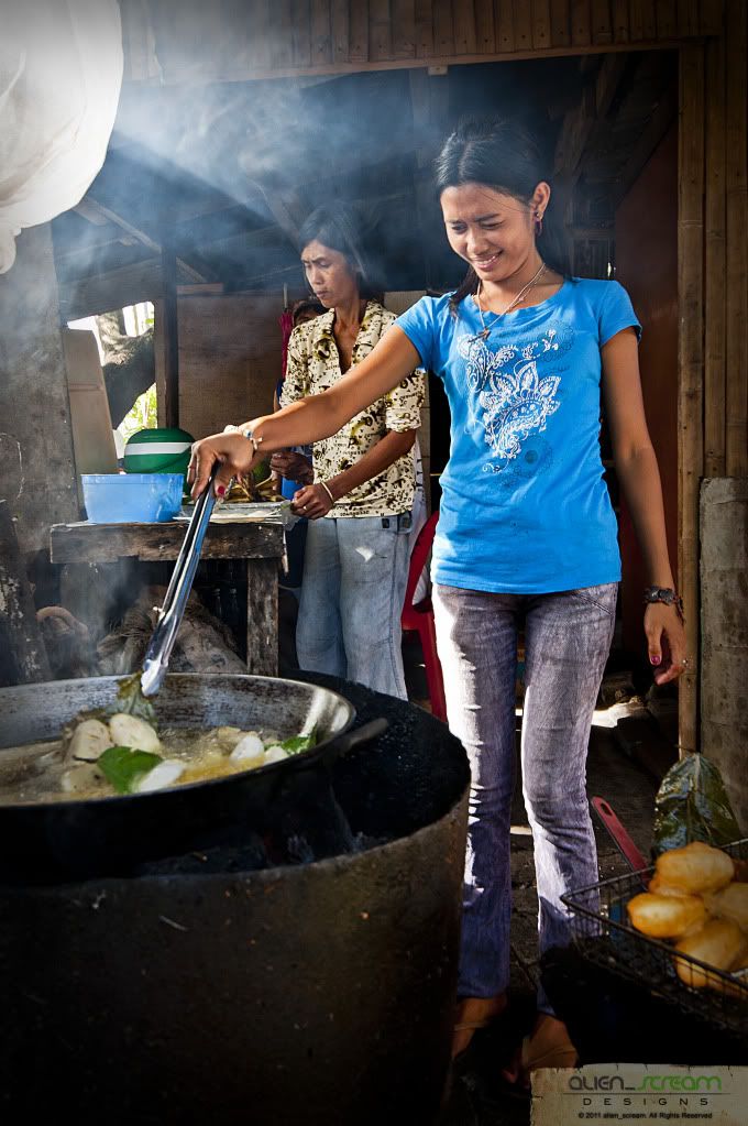
After my doctor’s appointment last Friday (16 September), we prepared out things for our road trip to the Bicol Region, taking the Bus at Jac Liner in Cubao to Sta. Rosa, Laguna by 1830hrs to meet up with the group at Walter Mart. Before the group arrives, we had to take a quick bite at Tropical Hut, which was about 2030hrs, where I ate their classic burgers and carol got burger steak. Taking our seats at the car, together with three others photographers, we headed out and started our journey around 2045hrs, which we plan to stop and take a rest at a gasoline station in Legaspi City. Arriving around 2200hrs, we were at Total Gas Station to rest and stretch our legs from the trip. By 2230hrs, we continued our journey passing thru the towns of Pagbilao, Atimonan, Gumaca, Plaridel, then to the town of Lopez, where we stopped at the house of our photographer friend to have coffee and pick-up his wife, who will be joining us on this trip. By 0200hrs, we headed out again passing thru the towns of Calauag, Sipocot, Naga, Pili, Baao, arriving at Iriga city by 0530hrs. Resting a bit from the trip, then we cooked breakfast, after which we then headed for the market to buy pork, chicken, shells and other stuffs for our lunch and dinner. Going back to the apartment, we started cooking food for an early lunch, where we ate shells and fried pork. We headed out again by 1015hrs going to Naga City where we would attend the Feast of our Lady of Peñafrancia. Parking at a relative’s house, we headed to Peñafrancia Basilica Minore to hear mass and see the church where the image of Our Lady of Peñafrancia is housed.
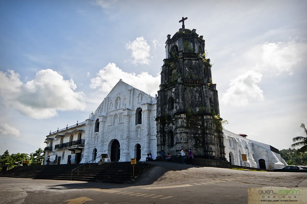
The
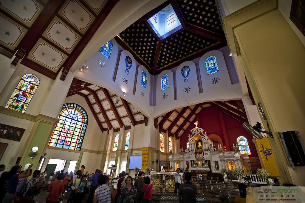
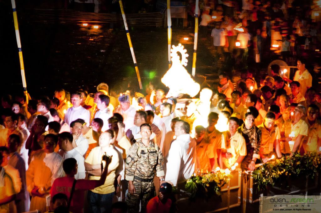
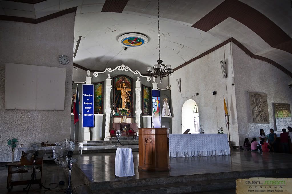
Peñafrancia Basilica Minore is located on the outskirts of. The Image of Our Lady of Peñafrancia is enshrined in her sanctuary at the Basilica Minore, Balatas Road Naga City.
It houses an image of the Virgin Mary, which was sculpted in 1710. The Basilica which was commissioned by Miguel de Cobarrubias, who moved from Spain with his family to the Philippines, and believes that the Virgin Mary had helped him numerous times in his life. The image was housed in a small chapel until the Basilica Minore was constructed.
We then headed for Rache’s Grill, where we would wait for the procession of the Lady of Peñafrancia to pass by. We picked our spots where we would take our photos then sat down to chat and have some beer.
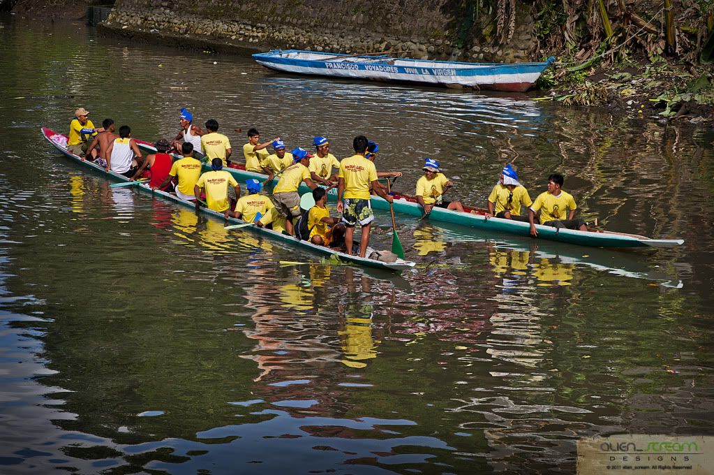
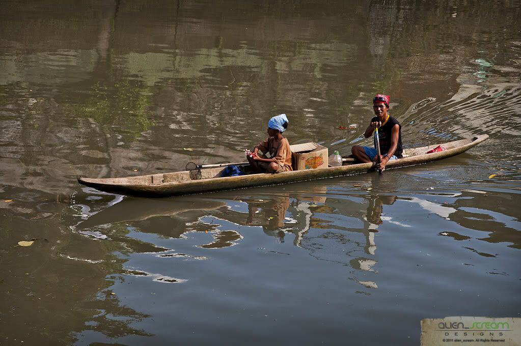
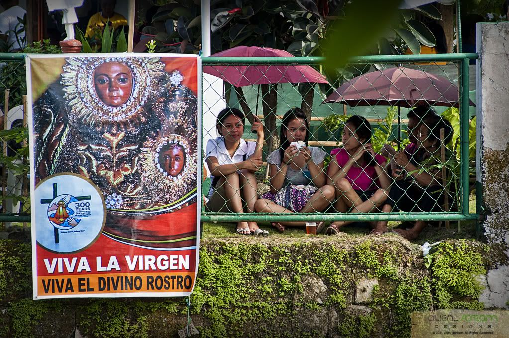
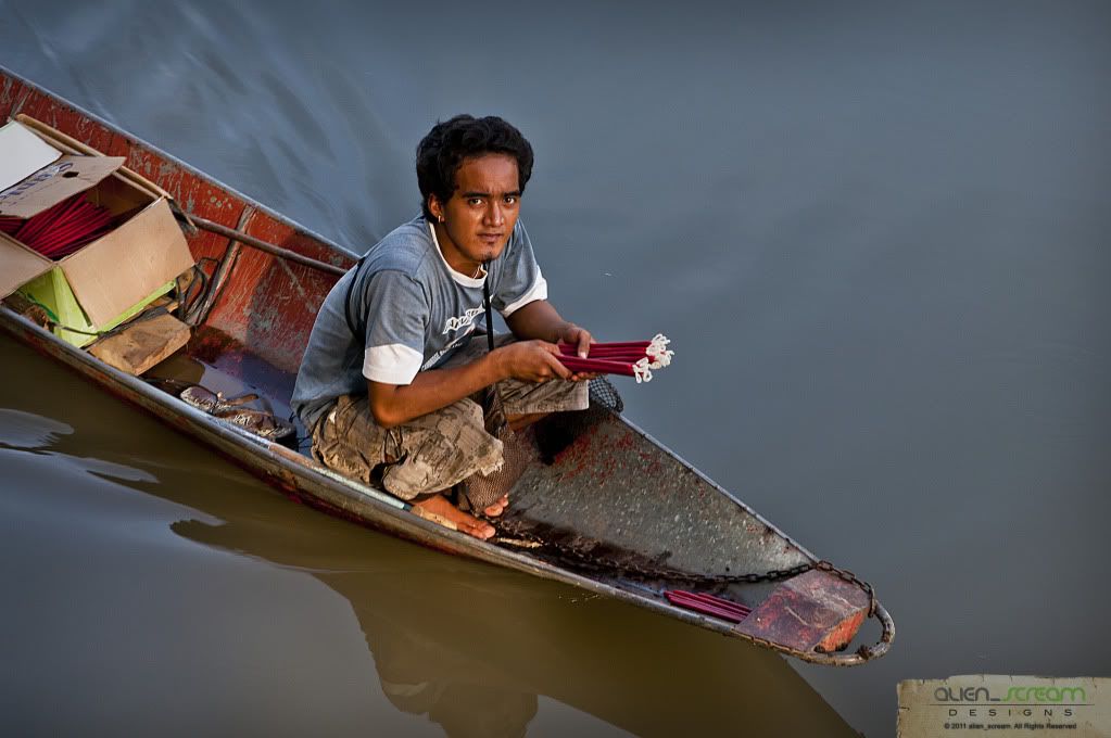
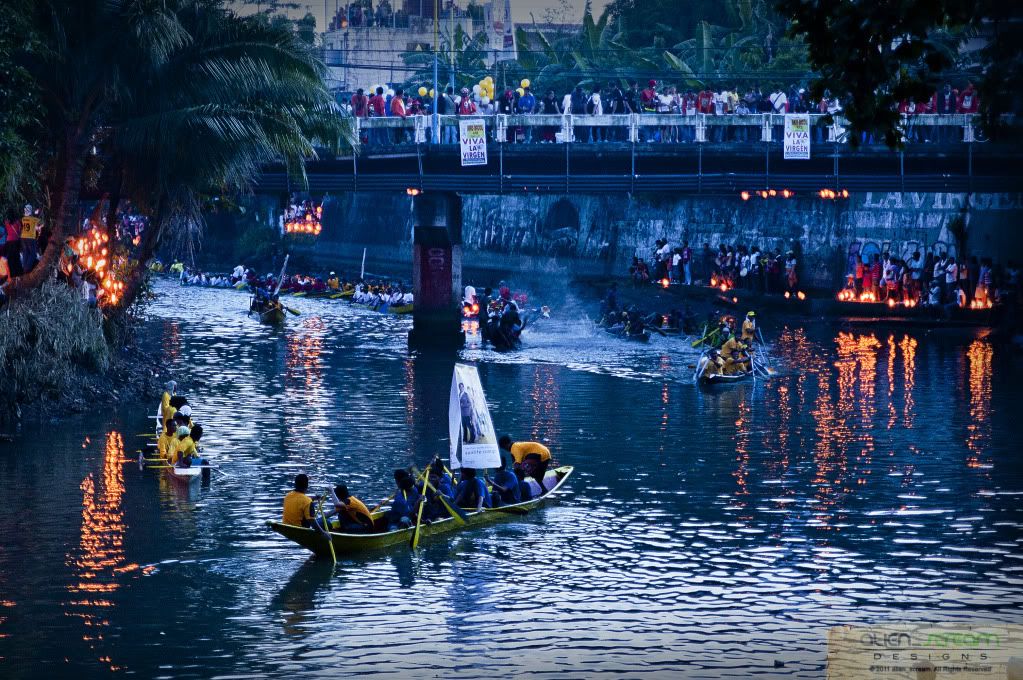
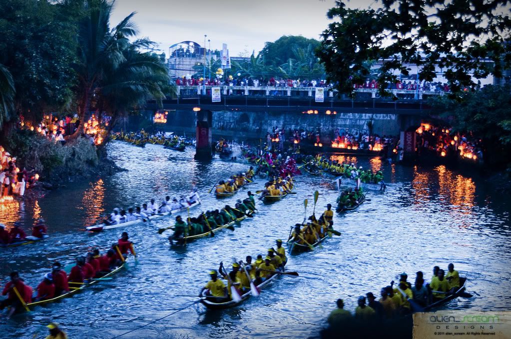
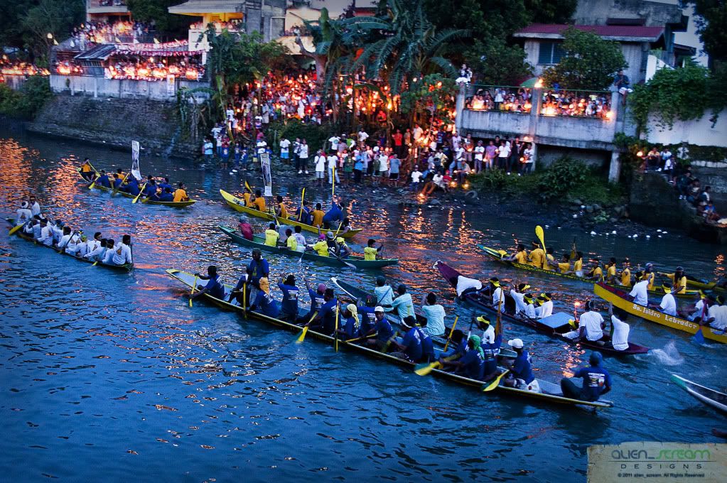
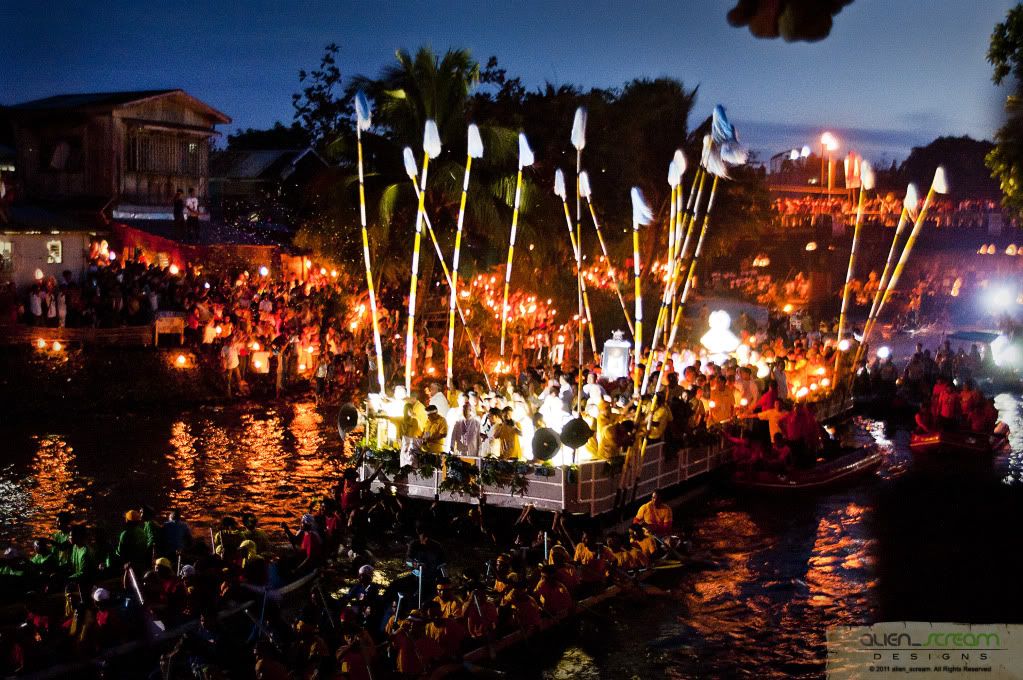
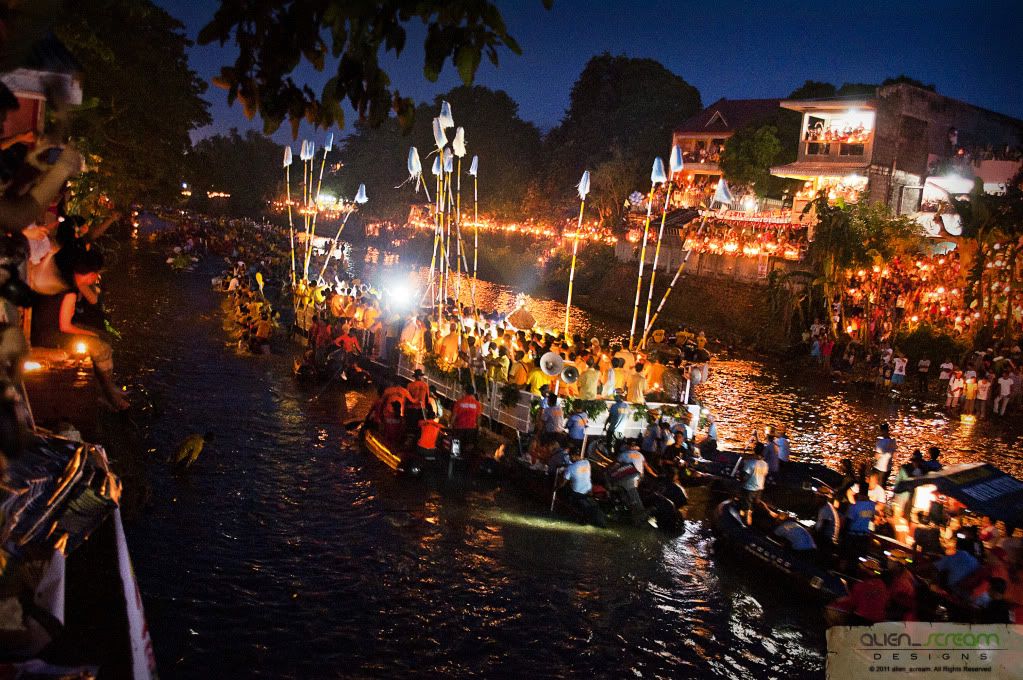
The feast of Our Lady of Peñafrancia is celebrated on the third Saturday of September in Naga City, Bicol. The feast day is preceded by a novena, nine days of prayer, in honor of the Virgin. On the first day, the image of the Virgin, a copy of the Madonna in Peñafrancia, Spain, is brought from its shrine to the Naga Cathedral where the novena is held. On the last day, the image is returned to her shrine following the Naga River route. The colorful evening procession is lit by thousands of candles from devotees in boats escorting the image. When the barge reaches its destination, the devotees shout "Viva la Virgen" (Long live the Virgin!) and the image is brought back in a procession to the cathedral.
According to locals, a Spanish government official from Peñafrancia, Spain, settled with his family in Cavite in 1712. One day, his daughter fell ill and the family prayed for her recovery to the famous Madonna of Peñafrancia, a picture of whom was in their possession. When the daughter recovered, the father vowed to build a chapel in honor of Our Lady of Peñafrancia in Manila. However, since he was being detained in Nueva Caceras, he built the chapel in that city, now known as Naga, instead.
The famous Madonna is believed to have miraculous powers. On her feast day, pilgrims gather at her shrine to pay her homage for favors received.
At about 1730hrs, the banks of the river has been filled up by people, and before 1800hrs, the first boats comes into view. Watching the pagoda passed by and taking photos of the procession was not quite good because of the available light that was there, which was getting too dark to get good photos.
After the procession was done, we walked back to the car passing thru the sea of people along the streets, getting back to the apartment at around 2030hrs and started heating up the food we cooked early in the morning. After eating dinner and freshening up, I felt tired and started drifting to sleep early and did not hear the commotion about the fire that was happening in the neighbor’s house, where I heard what happened the next day.
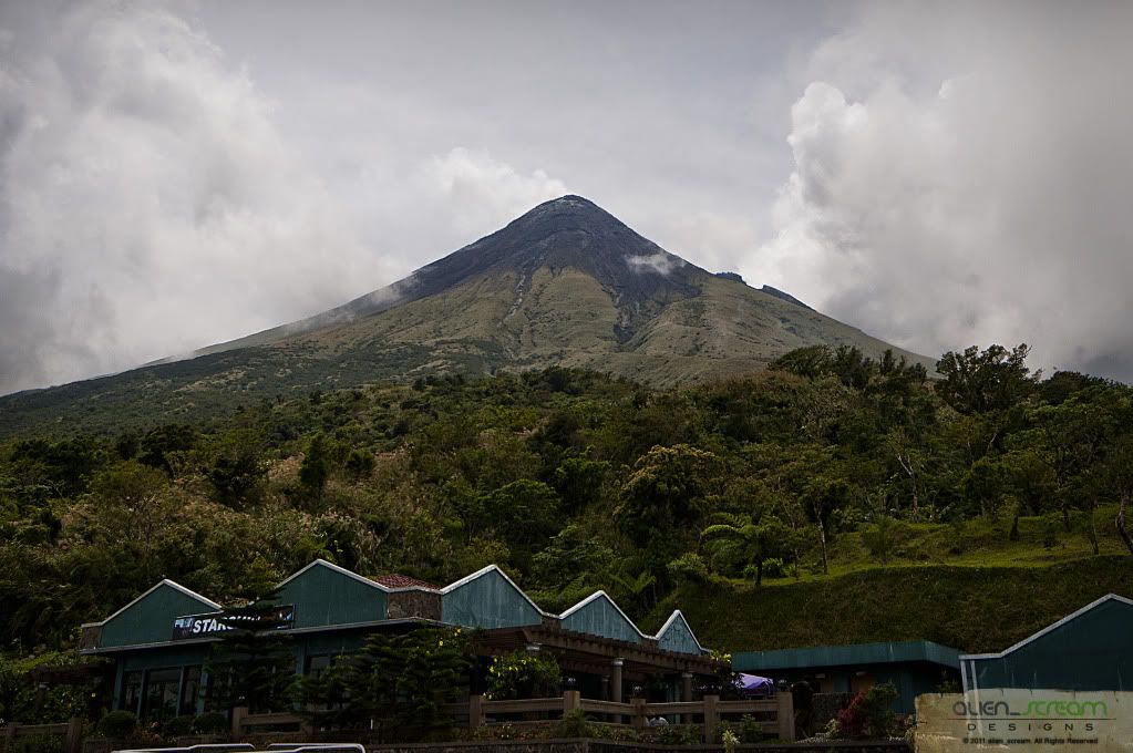
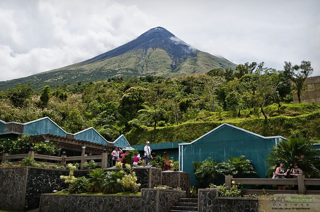
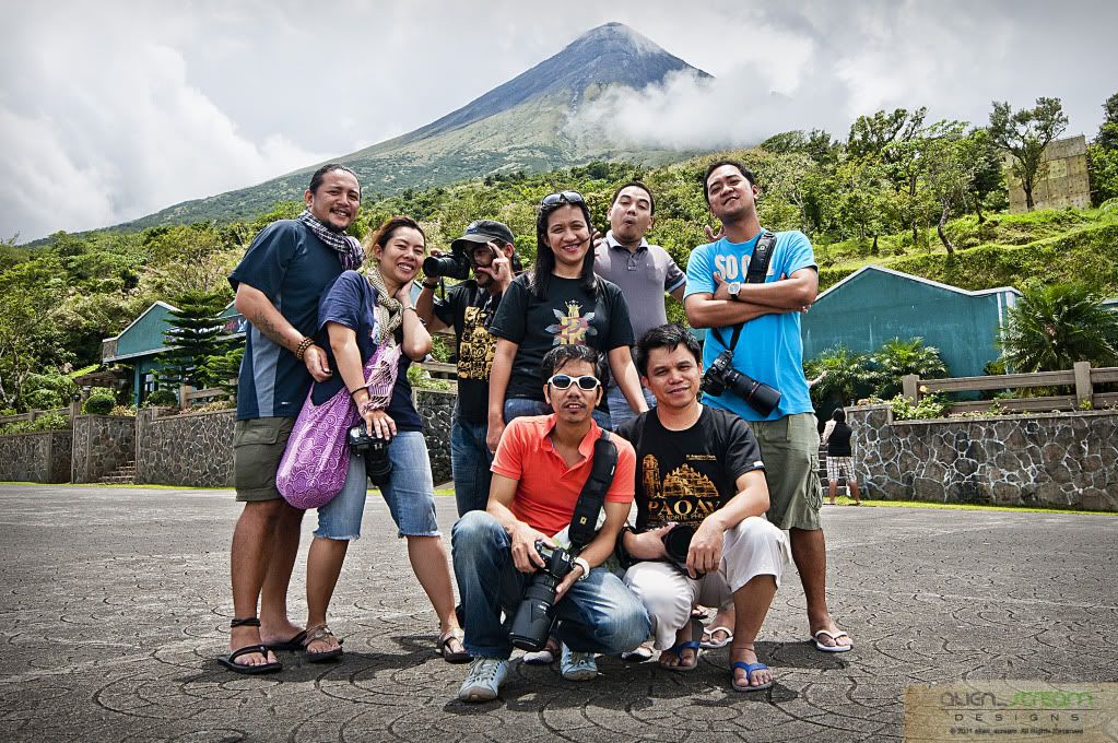
Waking up around 0600hrs and took and early bath, while eating breakfast I learned the full story about how the neighbor’s house caught on fire and how our friends help put out the fire, with all this happening and all the photographers in the house, no one had taken even a single photo of the fire. We left the house at around 0930hrs and headed for Mayon Rest House located halfway to the tip of Mayon Volcano.
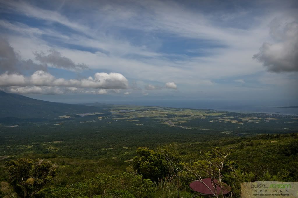
Mayon Rest House is located half way to the tip of Mayon Volcano, which is 8500 feet above sea level. The rest house was built beside the Seismological instrument initially built by the Americans, and now used by the Philippines Astronomical, Geological and Seismological Agency. This is also the starting point for mountaineers who climbed the peak of the volcano.
Based on studies from hundreds of years, this side of the volcano has not been hit by lava flow from the many eruptions of Mayon. A good enough reason why the instruments were installed to monitor the volcanic activity, and they were able to predict its forthcoming eruptions.
There are many rare orchids found around the area with some of them are yet to be discovered. Because of its almost perfect cone shape, many believe that it has the same cosmic energy also derived from the Pyramids of Egypt, that is the healing power coming from the force and energy of the universe. Only that Mayon is a hundred times more powerful.
This Park has been part of many a memorable days in everyone's life in Bicol as youngsters. The temperature is as low as 10˚C and as high as 21˚C. The air is always fresh like the dawn of days.
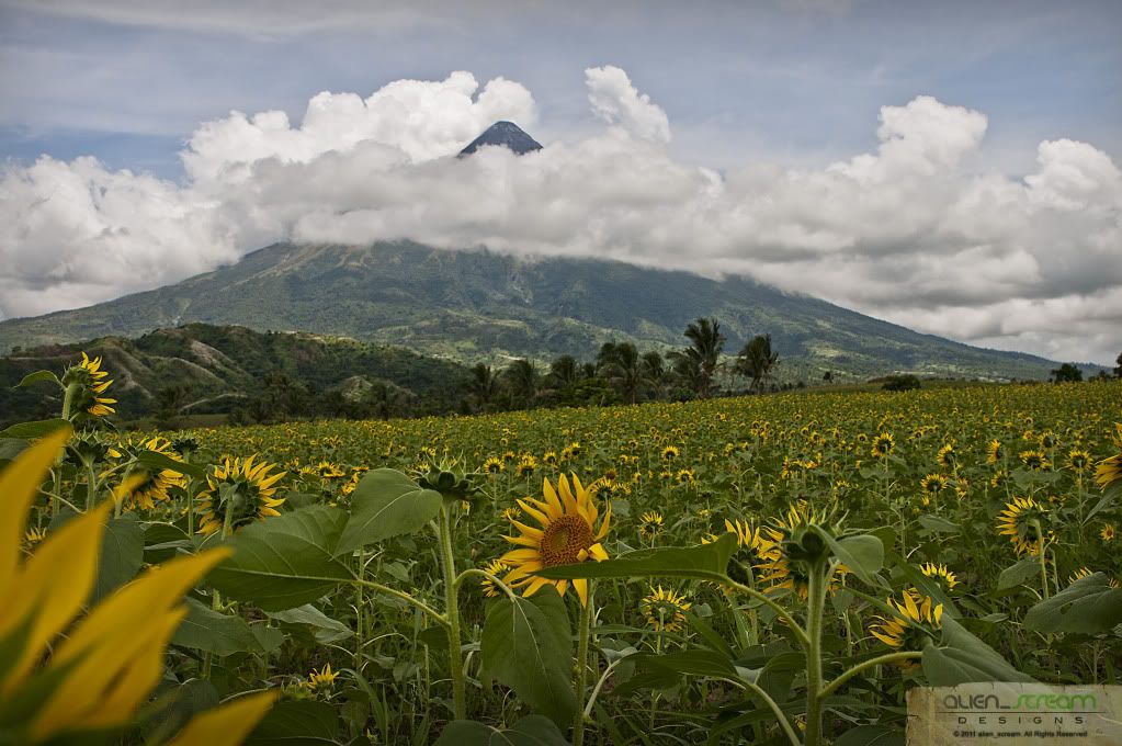
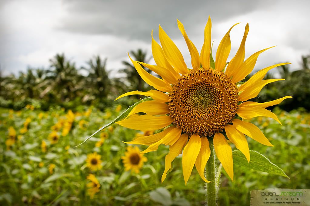
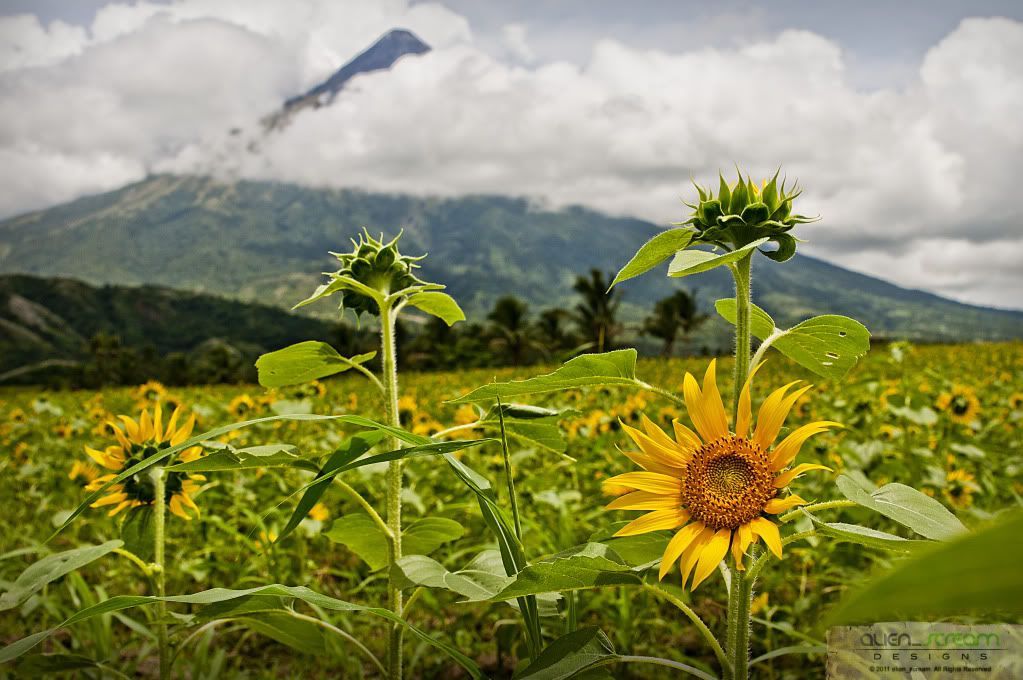
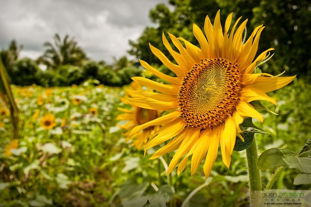
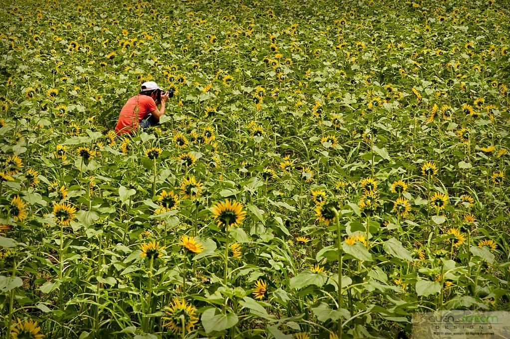
After visiting Mayon Rest House, we headed back to a patch of land where they planted sunflowers and took some photos of sunflowers with Mayon Volcano as its backdrop. Wished we could stay long here and wait for the clouds to clear to get a better picture but have to head out to the town of Daraga.
The Municipality of
Daraga is located in the Southwest portion of Albay Province or at geographical coordinates of between 123 124 degrees longitude and between 13 14 degrees latitude. It is bounded on the North by Legazpi City; on the south by the Province of Sorsogon particularly the municipality of Pilar; on the East by Legazpi City and on the West by the Municipalities of Camalig and Jovellar.
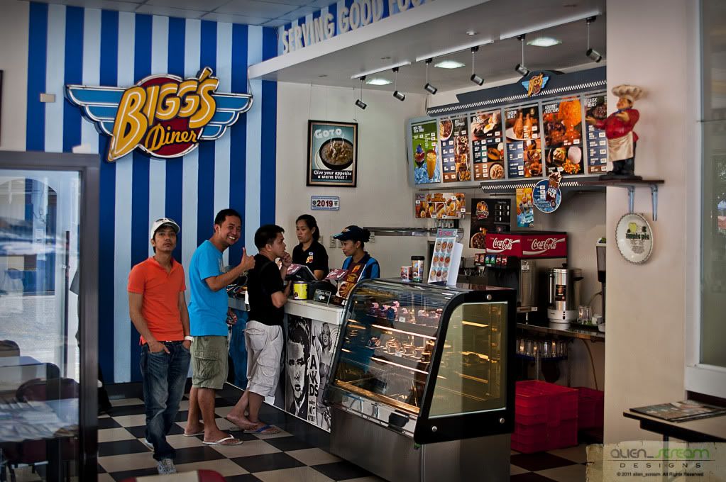
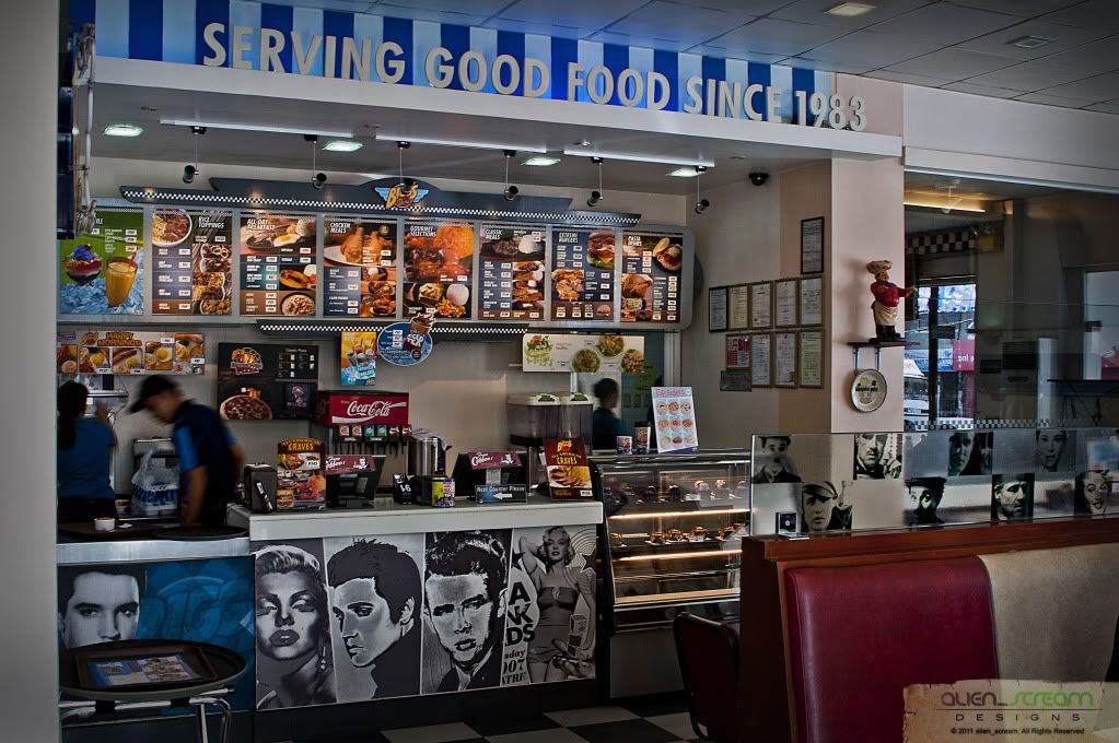
Here, we ate lunch at Bigg’s Diner, where we ate lunch. Here I had a big serving of burgers, while the others ate chicken, which is the specialty of the diner. After lunch we headed for Daraga Church or Parish Church of Nuestra Señora de la Porteria.
 Parish Church of Nuestra Señora de la Porteria
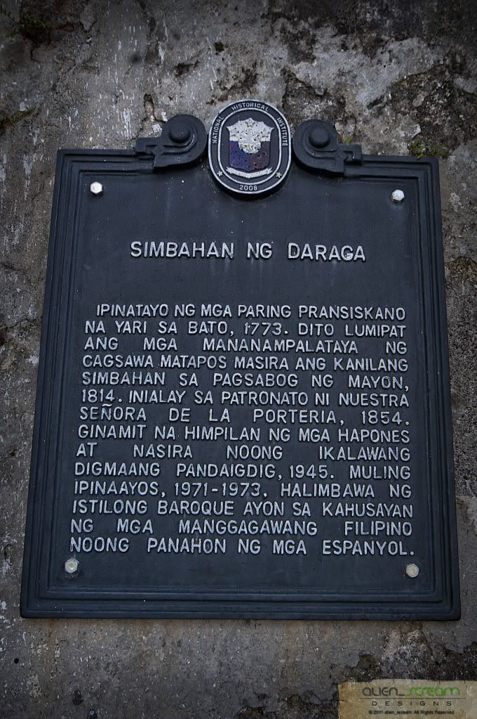
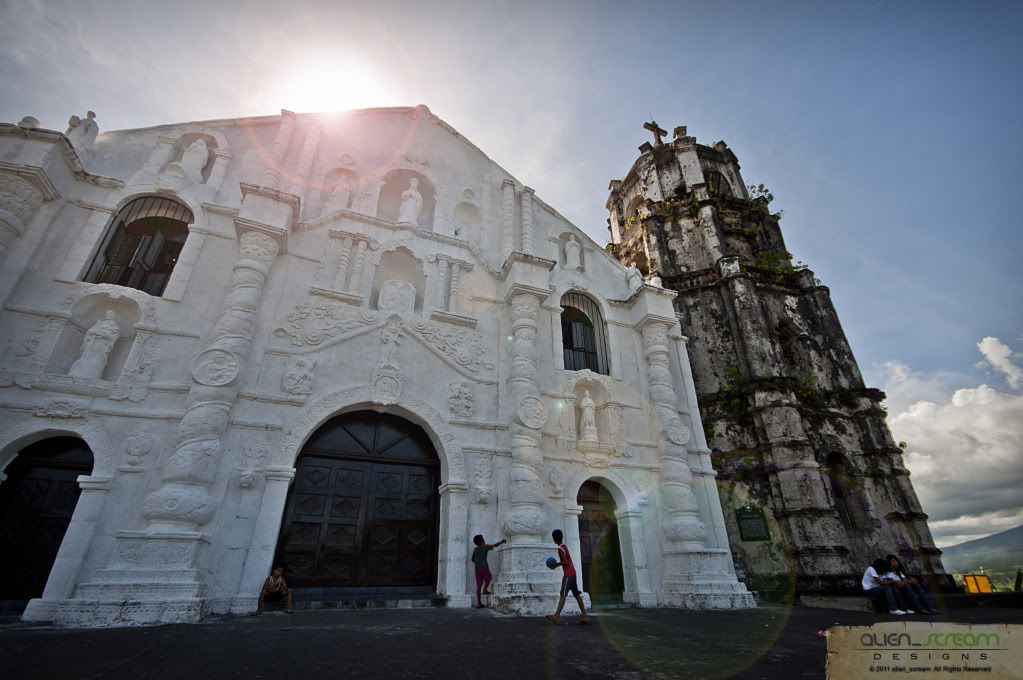
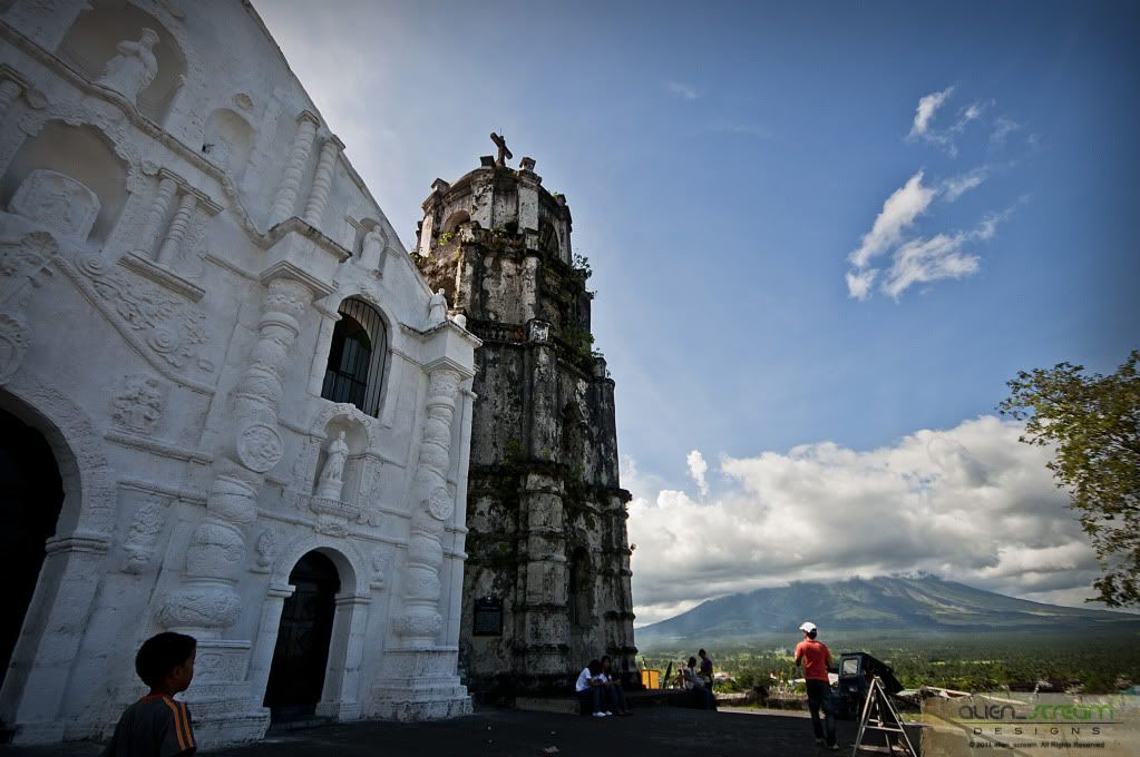
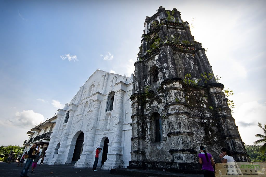
 was built by young maidens or Daraga is the common belief that it was built after and on account of the eruption of Mayon Volcano that buried the town of Cagsawa in 1814. The historical truth is that it began to be built more than 40 years earlier, in 1773 to be exact.
Historical records show that way back in 1772 some people from Cagsawa asked permission from the National Government to transfer their town and church to a nearly settlement known as Daraga, then a sitio of the town of Albay.
The request was granted by the Spanish Governor General, Don Simon de Anda y Salazar in a letter dated June 12, 1772, wherein he instructed the Alcade Mayor of the Province of Camarines to supervise the transfer of the town of Cagsawa to the place of Daraga so that the town be formed with streets near the church that is to serve as the center for the benefit of the natives.
The order must have been implemented right away. There is no better proof that the official seal of the municipality of Daraga that bears 1772 as the year engraved on it.
The church was still under construction and on its way to completion in 1777, as can be gathered from a letter written by the Franciscan Provincial to the Governor General, asking that it be finished and the latters letter of instruction to the Alcalde Mayor to find our whether the construction of the church is finished and in case it is not, to promote its completion with the greatest vigor. Whether it was completed before the fateful eruption of 1814 has not yet been ascertained.
The next thing we here about Daraga church is that it was finally consecrated in 1854, the year Pope Pius 1X declared the dogma of the Immaculate Conception of the Blessed Virgin Mary.
The American forces bombed the church during the World War II. The roof was completely blown up and the right wing and wall partially destroyed. Right after the war, it was hurriedly reconstructed. Then, it deteriorated very fast. In 1971 it underwent another complete reconstruction and remodeling of the interior especially the altar to make it conform to the norms of the celebration of the Liturgy as renewed by Council Vatican 11. The reconstruction was happily finished before the bicentennial celebration on December 8, 1973.
Eighteen years later in 1991, to be faithful to its structural design, the altar was returned to its original position.
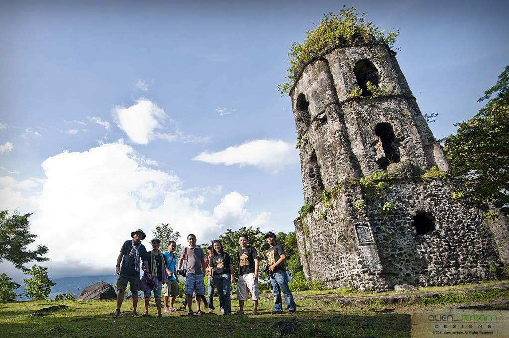
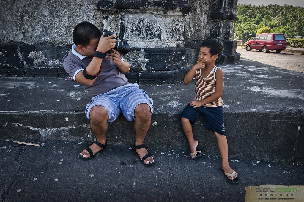
After our stop at Daraga Church, we headed for Cagsawa Ruins. The
Cagsawa Ruins (also spelled as Kagsawa or Cagsaua) are the remnants of an 18th century Franciscan Church, the Cagsawa church, built in 1724 and destroyed by the 1814 eruption of the Mayon Volcano. They are located in Barangay Busay, Cagsawa, in the municipality of Daraga, Albay, Philippines.
The ruins, currently protected in a park overseen by the municipal government of Daraga and the National Museum of the Philippines, are one of the most popular tourist destinations in the area. They are considered symbolic of the dangers of living in close proximity with the Mayon Volcano.
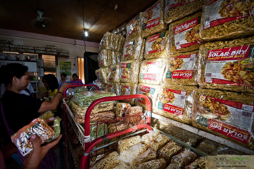
After our trip to the province of Albay, we headed back to Iriga passing thru the town of Bato, where we bought some pancit bato in Declaro’s Pancit Bato Factory. Back at Iriga, we freshened up and said goodbyes to our friends and then started our trip back to Manila by 1715hrs, with stop along the way and dinner at a stop in Calauag. Stopping at the Town of Lopez where one of our friend and his wife got off. With work the next day, I fell to sleep and woke up was already in the outskirts of Manila. Arriving in Manila around 0300hrs, and said our farewells to each other, we hit the sack to rest and had to wake up at 0530hrs.
With this road trip, I have seen for my self the Bicol Region, which I only read and see in books and magazines (I never remembered the time we went here for I was a very little boy back then). With memories in tow back to the city and the photos that I could share to others made this trip worthwhile. We did not only get to see the Feast of Our Lady of Peñafrancia but also the wonderful place Bicol Region has to offer.
I would, in the near future, would like to go back again and take a really nice photo of Mayon Volcano, what I got was all cloud-covered shots.
Till our next trip… HAPPY TRAILS!!!
Thanks to:
Sir Mervs: for inviting us on this trip, driving the whole way to bicol and back and letting us stay at his place.
And to our fellow photographers, Arnel and his wife, Mitch, Daniel, Elmer and Bob: salamat sa mga kwentohan at kalokohan nyo!
All photos are owned and copyrighted by Joey Rico (also known under these names: alien_scream).
All Rights Reserved. Unauthorized use, copy, editing, reproduction, publication, duplication and distribution of the digital photos, without his explicit permission, is punishable by law
This work is licensed under a
Creative Commons Attribution-Noncommercial-No Derivative Works 3.0 Philippines License.


 Bicol Express: Ang Byaheng Bicol
ITLog No.10
(16-18 September 2011)
What would you think of, when you say Bicol?
We usually think of the Food Bicol Express or Laing, the Mayon Volcano and the Feast of our Lady of Peñafrancia.
Bicol Region lies at 122° to 124° east longitude and 12° to 14° latitude or generally at the midsection of the country. Occupying the southern stretch of Luzon, the Bicol Peninsula is surrounded by natural barrier like bodies of water. The area is bounded on the north by Lamon Bay and Pacific Ocean on the East, the Sibuyan Sea and Ragay Gulf on the west. It has land access to the rest of Luzon through its neighbor on the north, Quezon Province.
The Bicol Region stretches towards the Pacific Ocean for more than 160 miles from the province of Camarines Norte in the northwest, to Sorsogon in the southwest. The underbelly of Bicol is composed of the provinces of Catanduanes and Masbate, which stand guard on the northern and southern approaches.
The Bicol region is composed of four contiguous provinces: ALBAY, CAMARINES SUR, CAMARINES NORTE, and SORSOGON; two island provinces of CATANDUANES and MASBATE and seven cities namely Legazpi City, Naga City, Iriga City, Tabaco City, Ligao City, Sorsogon City and Masbate City.
It has a total land area of 1,763,249 hectares of approximately 17,632,400 square kilometers. Camarines Sur is the biggest with 526,682 (Naga City and Iriga City included) and Catanduanes, the smallest with 151,148 hectares. The other provinces have the following areas: Albay-Legazpi – 255,257 has.; Camarines Norte – 211,249 has.; Masbate – 404,769 has. Of this land area, 1,250,460 hectares are alienable and disposable land while 359,789 hectares are public forest areas.
Long before any westerners reached the region, the ancient Bicols (the people) already has the culture of their own. They called their land IBALON, possibly after their chieftain-DATU GAT ABAAL, who ruled the inhabited territories from his seat of power at Sawangan on the mouth of Makabalo River, which is now the present day Legazpi City.
The sword and the cross of Spain reached Ibalon in 1570 when part of Legazpi Urdaneta expeditionary force headed by two Augustinian friars, Fr. Alonzo Jimenez and Fr. Juan Orca landed at the southwestern coast of the western peninsula. They named the southern part of the peninsula “TIERRA DE IBALON” and the northern part, “TIERRA DE CAMARINES”. Tierra de ibalon is also referred to as the first Christian settlement in the island of Luzon.
After the Christianization and colonization of Ibalon , the peninsula was divided in to two encomienda, the eastern portion. The Encomienda de Busaingan went to Pedro Arnedo, while the other half was given to Rodrigo Arias Giron. Busaingan, which means “breaker”, was the name given to the coastal settlement of the southern tip of Luzon, The present town of Santa Magdalena in Sorsogon Province.
Ibalon had a port call for galleon plying the Manila-Acapulco route. Historians believed that this could be what is now known as the port of Legazpi City. It was at this port that Bishop Salazar, the first bishop assigned to the Philippines, was stranded for the few weeks during he was able to learn the abuses of encomienderos.
It was believed that the report of Bishop Salazar could have been one of the causes for the abolition of the encomienda system in Ibalon, thus, paving the way for the birth of two original Bicol provinces- AMBOS CAMARINES which included Albay and Sorsogon.
The boundaries of the Region were clearly delineated in a decree issued by Spanish Governor General Narciso de Claveria on October 19,1836, fixing the territorial limits, Ambos Camarines underwent a series of divisions and fusions until 1919 when the Philippine Legislature enacted Act. No. 2809, creating the separate province of Camarines Sur.
Partido de Ibalon, which comprises the eastern part of the peninsula, had a change in name very much earlier when a decree was issued in 1663 renaming this political subdivision Albay. Some of the town of Ambos Camarines and Ibalon were interchanged. The islands of Catanduanes and Masbate were declared separate military districts.
Sorsogon, which used to be part of Albay beacame a province in 1894. By virtue of an executive order issued by Governor-General in 1908, Masbate was made a sub-province of Albay by the American Civil Government. It became an independent province on October 26, 1945 by virtue of the Commonwealth Act No. 687.
But presently, as the Bicolanos go back to rediscover their beginnings, they still favor the more native name: KABIKOLAN or simply BIKOL.
After my doctor’s appointment last Friday (16 September), we prepared out things for our road trip to the Bicol Region, taking the Bus at Jac Liner in Cubao to Sta. Rosa, Laguna by 1830hrs to meet up with the group at Walter Mart. Before the group arrives, we had to take a quick bite at Tropical Hut, which was about 2030hrs, where I ate their classic burgers and carol got burger steak. Taking our seats at the car, together with three others photographers, we headed out and started our journey around 2045hrs, which we plan to stop and take a rest at a gasoline station in Legaspi City. Arriving around 2200hrs, we were at Total Gas Station to rest and stretch our legs from the trip. By 2230hrs, we continued our journey passing thru the towns of Pagbilao, Atimonan, Gumaca, Plaridel, then to the town of Lopez, where we stopped at the house of our photographer friend to have coffee and pick-up his wife, who will be joining us on this trip. By 0200hrs, we headed out again passing thru the towns of Calauag, Sipocot, Naga, Pili, Baao, arriving at Iriga city by 0530hrs. Resting a bit from the trip, then we cooked breakfast, after which we then headed for the market to buy pork, chicken, shells and other stuffs for our lunch and dinner. Going back to the apartment, we started cooking food for an early lunch, where we ate shells and fried pork. We headed out again by 1015hrs going to Naga City where we would attend the Feast of our Lady of Peñafrancia. Parking at a relative’s house, we headed to Peñafrancia Basilica Minore to hear mass and see the church where the image of Our Lady of Peñafrancia is housed.
The Peñafrancia Basilica Minore is located on the outskirts of. The Image of Our Lady of Peñafrancia is enshrined in her sanctuary at the Basilica Minore, Balatas Road Naga City.
It houses an image of the Virgin Mary, which was sculpted in 1710. The Basilica which was commissioned by Miguel de Cobarrubias, who moved from Spain with his family to the Philippines, and believes that the Virgin Mary had helped him numerous times in his life. The image was housed in a small chapel until the Basilica Minore was constructed.
Bicol Express: Ang Byaheng Bicol
ITLog No.10
(16-18 September 2011)
What would you think of, when you say Bicol?
We usually think of the Food Bicol Express or Laing, the Mayon Volcano and the Feast of our Lady of Peñafrancia.
Bicol Region lies at 122° to 124° east longitude and 12° to 14° latitude or generally at the midsection of the country. Occupying the southern stretch of Luzon, the Bicol Peninsula is surrounded by natural barrier like bodies of water. The area is bounded on the north by Lamon Bay and Pacific Ocean on the East, the Sibuyan Sea and Ragay Gulf on the west. It has land access to the rest of Luzon through its neighbor on the north, Quezon Province.
The Bicol Region stretches towards the Pacific Ocean for more than 160 miles from the province of Camarines Norte in the northwest, to Sorsogon in the southwest. The underbelly of Bicol is composed of the provinces of Catanduanes and Masbate, which stand guard on the northern and southern approaches.
The Bicol region is composed of four contiguous provinces: ALBAY, CAMARINES SUR, CAMARINES NORTE, and SORSOGON; two island provinces of CATANDUANES and MASBATE and seven cities namely Legazpi City, Naga City, Iriga City, Tabaco City, Ligao City, Sorsogon City and Masbate City.
It has a total land area of 1,763,249 hectares of approximately 17,632,400 square kilometers. Camarines Sur is the biggest with 526,682 (Naga City and Iriga City included) and Catanduanes, the smallest with 151,148 hectares. The other provinces have the following areas: Albay-Legazpi – 255,257 has.; Camarines Norte – 211,249 has.; Masbate – 404,769 has. Of this land area, 1,250,460 hectares are alienable and disposable land while 359,789 hectares are public forest areas.
Long before any westerners reached the region, the ancient Bicols (the people) already has the culture of their own. They called their land IBALON, possibly after their chieftain-DATU GAT ABAAL, who ruled the inhabited territories from his seat of power at Sawangan on the mouth of Makabalo River, which is now the present day Legazpi City.
The sword and the cross of Spain reached Ibalon in 1570 when part of Legazpi Urdaneta expeditionary force headed by two Augustinian friars, Fr. Alonzo Jimenez and Fr. Juan Orca landed at the southwestern coast of the western peninsula. They named the southern part of the peninsula “TIERRA DE IBALON” and the northern part, “TIERRA DE CAMARINES”. Tierra de ibalon is also referred to as the first Christian settlement in the island of Luzon.
After the Christianization and colonization of Ibalon , the peninsula was divided in to two encomienda, the eastern portion. The Encomienda de Busaingan went to Pedro Arnedo, while the other half was given to Rodrigo Arias Giron. Busaingan, which means “breaker”, was the name given to the coastal settlement of the southern tip of Luzon, The present town of Santa Magdalena in Sorsogon Province.
Ibalon had a port call for galleon plying the Manila-Acapulco route. Historians believed that this could be what is now known as the port of Legazpi City. It was at this port that Bishop Salazar, the first bishop assigned to the Philippines, was stranded for the few weeks during he was able to learn the abuses of encomienderos.
It was believed that the report of Bishop Salazar could have been one of the causes for the abolition of the encomienda system in Ibalon, thus, paving the way for the birth of two original Bicol provinces- AMBOS CAMARINES which included Albay and Sorsogon.
The boundaries of the Region were clearly delineated in a decree issued by Spanish Governor General Narciso de Claveria on October 19,1836, fixing the territorial limits, Ambos Camarines underwent a series of divisions and fusions until 1919 when the Philippine Legislature enacted Act. No. 2809, creating the separate province of Camarines Sur.
Partido de Ibalon, which comprises the eastern part of the peninsula, had a change in name very much earlier when a decree was issued in 1663 renaming this political subdivision Albay. Some of the town of Ambos Camarines and Ibalon were interchanged. The islands of Catanduanes and Masbate were declared separate military districts.
Sorsogon, which used to be part of Albay beacame a province in 1894. By virtue of an executive order issued by Governor-General in 1908, Masbate was made a sub-province of Albay by the American Civil Government. It became an independent province on October 26, 1945 by virtue of the Commonwealth Act No. 687.
But presently, as the Bicolanos go back to rediscover their beginnings, they still favor the more native name: KABIKOLAN or simply BIKOL.
After my doctor’s appointment last Friday (16 September), we prepared out things for our road trip to the Bicol Region, taking the Bus at Jac Liner in Cubao to Sta. Rosa, Laguna by 1830hrs to meet up with the group at Walter Mart. Before the group arrives, we had to take a quick bite at Tropical Hut, which was about 2030hrs, where I ate their classic burgers and carol got burger steak. Taking our seats at the car, together with three others photographers, we headed out and started our journey around 2045hrs, which we plan to stop and take a rest at a gasoline station in Legaspi City. Arriving around 2200hrs, we were at Total Gas Station to rest and stretch our legs from the trip. By 2230hrs, we continued our journey passing thru the towns of Pagbilao, Atimonan, Gumaca, Plaridel, then to the town of Lopez, where we stopped at the house of our photographer friend to have coffee and pick-up his wife, who will be joining us on this trip. By 0200hrs, we headed out again passing thru the towns of Calauag, Sipocot, Naga, Pili, Baao, arriving at Iriga city by 0530hrs. Resting a bit from the trip, then we cooked breakfast, after which we then headed for the market to buy pork, chicken, shells and other stuffs for our lunch and dinner. Going back to the apartment, we started cooking food for an early lunch, where we ate shells and fried pork. We headed out again by 1015hrs going to Naga City where we would attend the Feast of our Lady of Peñafrancia. Parking at a relative’s house, we headed to Peñafrancia Basilica Minore to hear mass and see the church where the image of Our Lady of Peñafrancia is housed.
The Peñafrancia Basilica Minore is located on the outskirts of. The Image of Our Lady of Peñafrancia is enshrined in her sanctuary at the Basilica Minore, Balatas Road Naga City.
It houses an image of the Virgin Mary, which was sculpted in 1710. The Basilica which was commissioned by Miguel de Cobarrubias, who moved from Spain with his family to the Philippines, and believes that the Virgin Mary had helped him numerous times in his life. The image was housed in a small chapel until the Basilica Minore was constructed.


 We then headed for Rache’s Grill, where we would wait for the procession of the Lady of Peñafrancia to pass by. We picked our spots where we would take our photos then sat down to chat and have some beer.
The feast of Our Lady of Peñafrancia is celebrated on the third Saturday of September in Naga City, Bicol. The feast day is preceded by a novena, nine days of prayer, in honor of the Virgin. On the first day, the image of the Virgin, a copy of the Madonna in Peñafrancia, Spain, is brought from its shrine to the Naga Cathedral where the novena is held. On the last day, the image is returned to her shrine following the Naga River route. The colorful evening procession is lit by thousands of candles from devotees in boats escorting the image. When the barge reaches its destination, the devotees shout "Viva la Virgen" (Long live the Virgin!) and the image is brought back in a procession to the cathedral.
According to locals, a Spanish government official from Peñafrancia, Spain, settled with his family in Cavite in 1712. One day, his daughter fell ill and the family prayed for her recovery to the famous Madonna of Peñafrancia, a picture of whom was in their possession. When the daughter recovered, the father vowed to build a chapel in honor of Our Lady of Peñafrancia in Manila. However, since he was being detained in Nueva Caceras, he built the chapel in that city, now known as Naga, instead.
The famous Madonna is believed to have miraculous powers. On her feast day, pilgrims gather at her shrine to pay her homage for favors received.
At about 1730hrs, the banks of the river has been filled up by people, and before 1800hrs, the first boats comes into view. Watching the pagoda passed by and taking photos of the procession was not quite good because of the available light that was there, which was getting too dark to get good photos.
We then headed for Rache’s Grill, where we would wait for the procession of the Lady of Peñafrancia to pass by. We picked our spots where we would take our photos then sat down to chat and have some beer.
The feast of Our Lady of Peñafrancia is celebrated on the third Saturday of September in Naga City, Bicol. The feast day is preceded by a novena, nine days of prayer, in honor of the Virgin. On the first day, the image of the Virgin, a copy of the Madonna in Peñafrancia, Spain, is brought from its shrine to the Naga Cathedral where the novena is held. On the last day, the image is returned to her shrine following the Naga River route. The colorful evening procession is lit by thousands of candles from devotees in boats escorting the image. When the barge reaches its destination, the devotees shout "Viva la Virgen" (Long live the Virgin!) and the image is brought back in a procession to the cathedral.
According to locals, a Spanish government official from Peñafrancia, Spain, settled with his family in Cavite in 1712. One day, his daughter fell ill and the family prayed for her recovery to the famous Madonna of Peñafrancia, a picture of whom was in their possession. When the daughter recovered, the father vowed to build a chapel in honor of Our Lady of Peñafrancia in Manila. However, since he was being detained in Nueva Caceras, he built the chapel in that city, now known as Naga, instead.
The famous Madonna is believed to have miraculous powers. On her feast day, pilgrims gather at her shrine to pay her homage for favors received.
At about 1730hrs, the banks of the river has been filled up by people, and before 1800hrs, the first boats comes into view. Watching the pagoda passed by and taking photos of the procession was not quite good because of the available light that was there, which was getting too dark to get good photos.


 After the procession was done, we walked back to the car passing thru the sea of people along the streets, getting back to the apartment at around 2030hrs and started heating up the food we cooked early in the morning. After eating dinner and freshening up, I felt tired and started drifting to sleep early and did not hear the commotion about the fire that was happening in the neighbor’s house, where I heard what happened the next day.
Waking up around 0600hrs and took and early bath, while eating breakfast I learned the full story about how the neighbor’s house caught on fire and how our friends help put out the fire, with all this happening and all the photographers in the house, no one had taken even a single photo of the fire. We left the house at around 0930hrs and headed for Mayon Rest House located halfway to the tip of Mayon Volcano.
Mayon Rest House is located half way to the tip of Mayon Volcano, which is 8500 feet above sea level. The rest house was built beside the Seismological instrument initially built by the Americans, and now used by the Philippines Astronomical, Geological and Seismological Agency. This is also the starting point for mountaineers who climbed the peak of the volcano.
Based on studies from hundreds of years, this side of the volcano has not been hit by lava flow from the many eruptions of Mayon. A good enough reason why the instruments were installed to monitor the volcanic activity, and they were able to predict its forthcoming eruptions.
There are many rare orchids found around the area with some of them are yet to be discovered. Because of its almost perfect cone shape, many believe that it has the same cosmic energy also derived from the Pyramids of Egypt, that is the healing power coming from the force and energy of the universe. Only that Mayon is a hundred times more powerful.
This Park has been part of many a memorable days in everyone's life in Bicol as youngsters. The temperature is as low as 10˚C and as high as 21˚C. The air is always fresh like the dawn of days.
After the procession was done, we walked back to the car passing thru the sea of people along the streets, getting back to the apartment at around 2030hrs and started heating up the food we cooked early in the morning. After eating dinner and freshening up, I felt tired and started drifting to sleep early and did not hear the commotion about the fire that was happening in the neighbor’s house, where I heard what happened the next day.
Waking up around 0600hrs and took and early bath, while eating breakfast I learned the full story about how the neighbor’s house caught on fire and how our friends help put out the fire, with all this happening and all the photographers in the house, no one had taken even a single photo of the fire. We left the house at around 0930hrs and headed for Mayon Rest House located halfway to the tip of Mayon Volcano.
Mayon Rest House is located half way to the tip of Mayon Volcano, which is 8500 feet above sea level. The rest house was built beside the Seismological instrument initially built by the Americans, and now used by the Philippines Astronomical, Geological and Seismological Agency. This is also the starting point for mountaineers who climbed the peak of the volcano.
Based on studies from hundreds of years, this side of the volcano has not been hit by lava flow from the many eruptions of Mayon. A good enough reason why the instruments were installed to monitor the volcanic activity, and they were able to predict its forthcoming eruptions.
There are many rare orchids found around the area with some of them are yet to be discovered. Because of its almost perfect cone shape, many believe that it has the same cosmic energy also derived from the Pyramids of Egypt, that is the healing power coming from the force and energy of the universe. Only that Mayon is a hundred times more powerful.
This Park has been part of many a memorable days in everyone's life in Bicol as youngsters. The temperature is as low as 10˚C and as high as 21˚C. The air is always fresh like the dawn of days.


 After visiting Mayon Rest House, we headed back to a patch of land where they planted sunflowers and took some photos of sunflowers with Mayon Volcano as its backdrop. Wished we could stay long here and wait for the clouds to clear to get a better picture but have to head out to the town of Daraga.


 The Municipality of Daraga is located in the Southwest portion of Albay Province or at geographical coordinates of between 123 124 degrees longitude and between 13 14 degrees latitude. It is bounded on the North by Legazpi City; on the south by the Province of Sorsogon particularly the municipality of Pilar; on the East by Legazpi City and on the West by the Municipalities of Camalig and Jovellar.
Here, we ate lunch at Bigg’s Diner, where we ate lunch. Here I had a big serving of burgers, while the others ate chicken, which is the specialty of the diner. After lunch we headed for Daraga Church or Parish Church of Nuestra Señora de la Porteria.
The Municipality of Daraga is located in the Southwest portion of Albay Province or at geographical coordinates of between 123 124 degrees longitude and between 13 14 degrees latitude. It is bounded on the North by Legazpi City; on the south by the Province of Sorsogon particularly the municipality of Pilar; on the East by Legazpi City and on the West by the Municipalities of Camalig and Jovellar.
Here, we ate lunch at Bigg’s Diner, where we ate lunch. Here I had a big serving of burgers, while the others ate chicken, which is the specialty of the diner. After lunch we headed for Daraga Church or Parish Church of Nuestra Señora de la Porteria.


 Parish Church of Nuestra Señora de la Porteria was built by young maidens or Daraga is the common belief that it was built after and on account of the eruption of Mayon Volcano that buried the town of Cagsawa in 1814. The historical truth is that it began to be built more than 40 years earlier, in 1773 to be exact.
Historical records show that way back in 1772 some people from Cagsawa asked permission from the National Government to transfer their town and church to a nearly settlement known as Daraga, then a sitio of the town of Albay.
The request was granted by the Spanish Governor General, Don Simon de Anda y Salazar in a letter dated June 12, 1772, wherein he instructed the Alcade Mayor of the Province of Camarines to supervise the transfer of the town of Cagsawa to the place of Daraga so that the town be formed with streets near the church that is to serve as the center for the benefit of the natives.
The order must have been implemented right away. There is no better proof that the official seal of the municipality of Daraga that bears 1772 as the year engraved on it.
The church was still under construction and on its way to completion in 1777, as can be gathered from a letter written by the Franciscan Provincial to the Governor General, asking that it be finished and the latters letter of instruction to the Alcalde Mayor to find our whether the construction of the church is finished and in case it is not, to promote its completion with the greatest vigor. Whether it was completed before the fateful eruption of 1814 has not yet been ascertained.
The next thing we here about Daraga church is that it was finally consecrated in 1854, the year Pope Pius 1X declared the dogma of the Immaculate Conception of the Blessed Virgin Mary.
The American forces bombed the church during the World War II. The roof was completely blown up and the right wing and wall partially destroyed. Right after the war, it was hurriedly reconstructed. Then, it deteriorated very fast. In 1971 it underwent another complete reconstruction and remodeling of the interior especially the altar to make it conform to the norms of the celebration of the Liturgy as renewed by Council Vatican 11. The reconstruction was happily finished before the bicentennial celebration on December 8, 1973.
Eighteen years later in 1991, to be faithful to its structural design, the altar was returned to its original position.
Parish Church of Nuestra Señora de la Porteria was built by young maidens or Daraga is the common belief that it was built after and on account of the eruption of Mayon Volcano that buried the town of Cagsawa in 1814. The historical truth is that it began to be built more than 40 years earlier, in 1773 to be exact.
Historical records show that way back in 1772 some people from Cagsawa asked permission from the National Government to transfer their town and church to a nearly settlement known as Daraga, then a sitio of the town of Albay.
The request was granted by the Spanish Governor General, Don Simon de Anda y Salazar in a letter dated June 12, 1772, wherein he instructed the Alcade Mayor of the Province of Camarines to supervise the transfer of the town of Cagsawa to the place of Daraga so that the town be formed with streets near the church that is to serve as the center for the benefit of the natives.
The order must have been implemented right away. There is no better proof that the official seal of the municipality of Daraga that bears 1772 as the year engraved on it.
The church was still under construction and on its way to completion in 1777, as can be gathered from a letter written by the Franciscan Provincial to the Governor General, asking that it be finished and the latters letter of instruction to the Alcalde Mayor to find our whether the construction of the church is finished and in case it is not, to promote its completion with the greatest vigor. Whether it was completed before the fateful eruption of 1814 has not yet been ascertained.
The next thing we here about Daraga church is that it was finally consecrated in 1854, the year Pope Pius 1X declared the dogma of the Immaculate Conception of the Blessed Virgin Mary.
The American forces bombed the church during the World War II. The roof was completely blown up and the right wing and wall partially destroyed. Right after the war, it was hurriedly reconstructed. Then, it deteriorated very fast. In 1971 it underwent another complete reconstruction and remodeling of the interior especially the altar to make it conform to the norms of the celebration of the Liturgy as renewed by Council Vatican 11. The reconstruction was happily finished before the bicentennial celebration on December 8, 1973.
Eighteen years later in 1991, to be faithful to its structural design, the altar was returned to its original position.


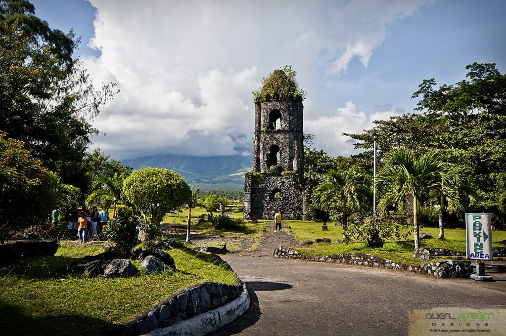
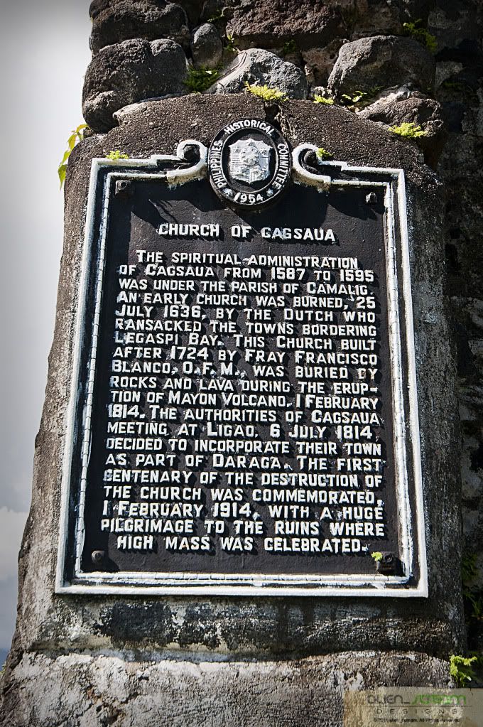
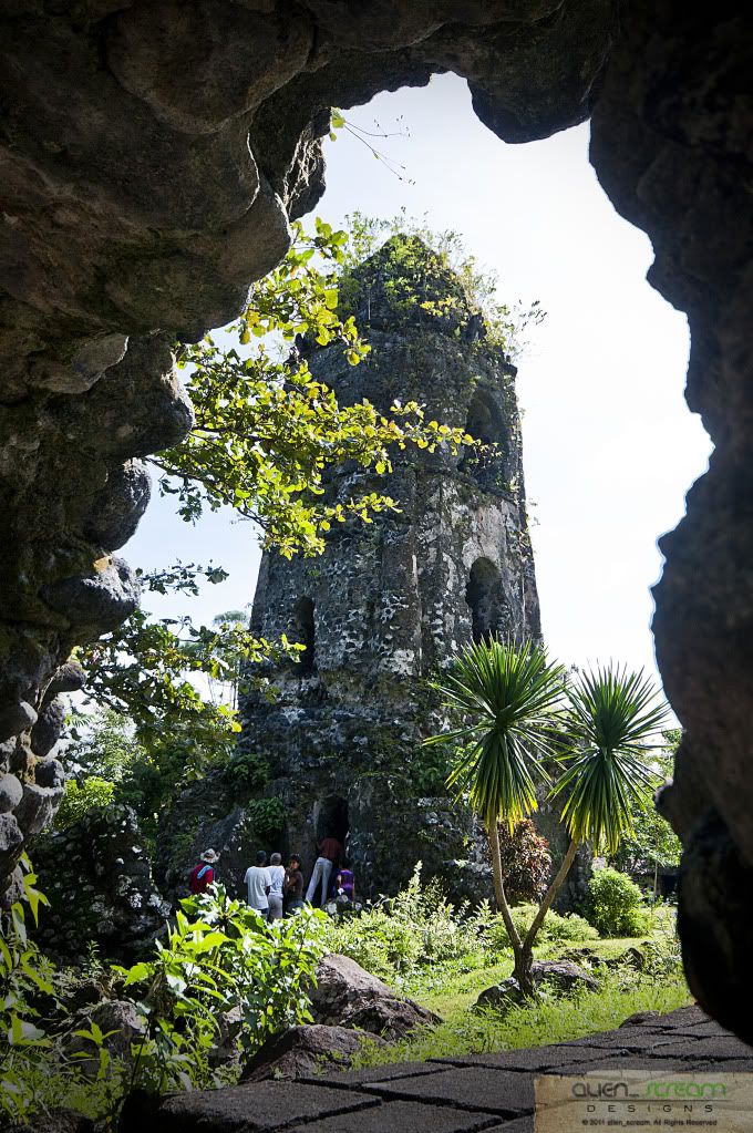
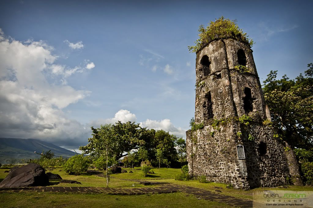
 After our stop at Daraga Church, we headed for Cagsawa Ruins. The Cagsawa Ruins (also spelled as Kagsawa or Cagsaua) are the remnants of an 18th century Franciscan Church, the Cagsawa church, built in 1724 and destroyed by the 1814 eruption of the Mayon Volcano. They are located in Barangay Busay, Cagsawa, in the municipality of Daraga, Albay, Philippines.
The ruins, currently protected in a park overseen by the municipal government of Daraga and the National Museum of the Philippines, are one of the most popular tourist destinations in the area. They are considered symbolic of the dangers of living in close proximity with the Mayon Volcano.
After our stop at Daraga Church, we headed for Cagsawa Ruins. The Cagsawa Ruins (also spelled as Kagsawa or Cagsaua) are the remnants of an 18th century Franciscan Church, the Cagsawa church, built in 1724 and destroyed by the 1814 eruption of the Mayon Volcano. They are located in Barangay Busay, Cagsawa, in the municipality of Daraga, Albay, Philippines.
The ruins, currently protected in a park overseen by the municipal government of Daraga and the National Museum of the Philippines, are one of the most popular tourist destinations in the area. They are considered symbolic of the dangers of living in close proximity with the Mayon Volcano.


 After our trip to the province of Albay, we headed back to Iriga passing thru the town of Bato, where we bought some pancit bato in Declaro’s Pancit Bato Factory. Back at Iriga, we freshened up and said goodbyes to our friends and then started our trip back to Manila by 1715hrs, with stop along the way and dinner at a stop in Calauag. Stopping at the Town of Lopez where one of our friend and his wife got off. With work the next day, I fell to sleep and woke up was already in the outskirts of Manila. Arriving in Manila around 0300hrs, and said our farewells to each other, we hit the sack to rest and had to wake up at 0530hrs.

 With this road trip, I have seen for my self the Bicol Region, which I only read and see in books and magazines (I never remembered the time we went here for I was a very little boy back then). With memories in tow back to the city and the photos that I could share to others made this trip worthwhile. We did not only get to see the Feast of Our Lady of Peñafrancia but also the wonderful place Bicol Region has to offer.
I would, in the near future, would like to go back again and take a really nice photo of Mayon Volcano, what I got was all cloud-covered shots.
Till our next trip… HAPPY TRAILS!!!
Thanks to:
Sir Mervs: for inviting us on this trip, driving the whole way to bicol and back and letting us stay at his place.
And to our fellow photographers, Arnel and his wife, Mitch, Daniel, Elmer and Bob: salamat sa mga kwentohan at kalokohan nyo!
With this road trip, I have seen for my self the Bicol Region, which I only read and see in books and magazines (I never remembered the time we went here for I was a very little boy back then). With memories in tow back to the city and the photos that I could share to others made this trip worthwhile. We did not only get to see the Feast of Our Lady of Peñafrancia but also the wonderful place Bicol Region has to offer.
I would, in the near future, would like to go back again and take a really nice photo of Mayon Volcano, what I got was all cloud-covered shots.
Till our next trip… HAPPY TRAILS!!!
Thanks to:
Sir Mervs: for inviting us on this trip, driving the whole way to bicol and back and letting us stay at his place.
And to our fellow photographers, Arnel and his wife, Mitch, Daniel, Elmer and Bob: salamat sa mga kwentohan at kalokohan nyo!


 All photos are owned and copyrighted by Joey Rico (also known under these names: alien_scream).
All Rights Reserved. Unauthorized use, copy, editing, reproduction, publication, duplication and distribution of the digital photos, without his explicit permission, is punishable by law
This work is licensed under a Creative Commons Attribution-Noncommercial-No Derivative Works 3.0 Philippines License.
All photos are owned and copyrighted by Joey Rico (also known under these names: alien_scream).
All Rights Reserved. Unauthorized use, copy, editing, reproduction, publication, duplication and distribution of the digital photos, without his explicit permission, is punishable by law
This work is licensed under a Creative Commons Attribution-Noncommercial-No Derivative Works 3.0 Philippines License.

